


La boucle

sameja
User
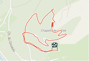

Length
1.9 km

Max alt
688 m

Uphill gradient
99 m
Km-Effort
3.2 km

Min alt
603 m

Downhill gradient
97 m
Boucle
Yes
Creation date :
2025-07-03 03:26:54.0
Updated on :
2025-07-03 04:11:07.143
25m
Difficulty : Easy

FREE GPS app for hiking
 SityTrail
IGN / Geographical institutes
SityTrail Plus
The world is yours!
About
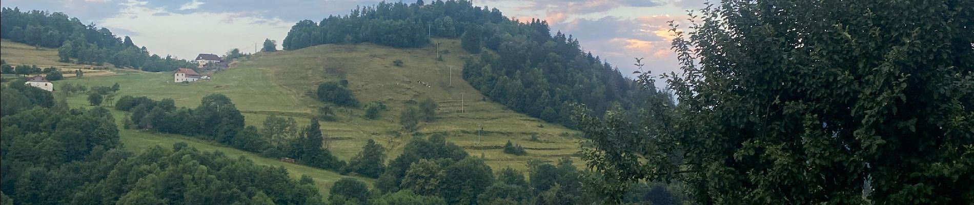
Trail Trail of 1.9 km to be discovered at Grand Est, Vosges, Le Ménil. This trail is proposed by sameja.
Description
Le Ménil
Photos


Positioning
Country:
France
Region :
Grand Est
Department/Province :
Vosges
Municipality :
Le Ménil
Location:
Unknown
Start:(Dec)
Start:(UTM)
335896 ; 5308964 (32T) N.
Comments